| Highest | Unnamed |
|---|---|
| Elevation | 901 m |
| Parent | Verkhoyansk Range East Siberian System |
| Location | Sakha Republic (Yakutia), Russian Far East |
| Geology | Sandstone, limestone |
| Orogeny | Alpine orogeny |
| Range coordinates | 61°06′N 135°47′E |
| Length | 100 km |
| Length orientation | N/S |
| Width | 30 km |
| Width orientation | E/W |
| Easiest route | From Eldikan |
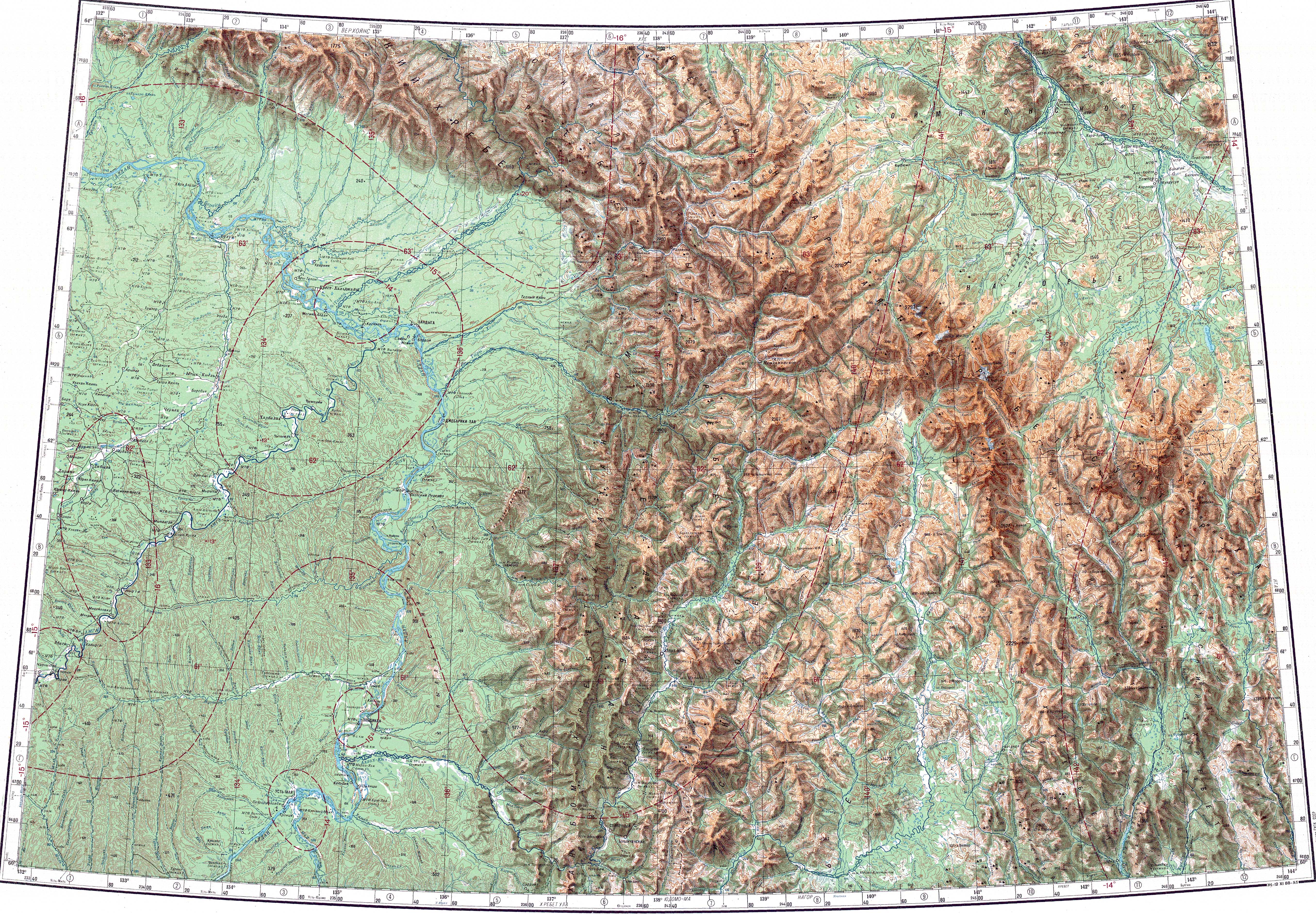
The Kyllakh Range (Russian: Кыллахский хребет; sah: Кыыллаах) is a range of mountains in the Russian Federation. Administratively the mountain chain belongs to the Sakha Republic. It is the smallest of the ranges which are part of the southern prolongation of the Verkhoyansk Range, East Siberian System.
Geography
The Kyllakh Range stretches roughly from north to south for about 100 kilometres (62 mi) to the southwest of the Ulakhan-Bom, one of the three longer parallel ranges that form a group to the east.[1] It is bound in the north by the Khanda river. To the west it is limited by the banks of the Aldan River and to the south by the Allakh-Yun river. The highest point of the mountain chain is an unnamed 901 metres (2,956 ft) high summit.[2][3]
Flora
The slopes of the range are largely bare, but may be covered by larch taiga in slopes just above valleys, as well as birch in slopes facing the Aldan.[4] Most of the river valleys are swampy with widespread moss growth.[1]
See also
References
- ^ Relief of the Sette Daban, Yakutia
- ^ P-53 54 Map (in Russian)
- ^ Google Earth
- ^ Moss flora of Sette-Daban Range (Yakutia)